Visually impressive’ is just one phrase bandied about when talk turns to Utah’s Bryce Canyon National Park. Awe inspiring’ is another.
Day trippers head to the 56.2 square mile Bryce Canyon to revel in its horseshoe-shaped amphitheaters colourful limestone rock, slot canyons, windows, fins, and hoodoo’ spires. It sits over three climactic zones: spruce/fir forest, Ponderosa Pine forest, and Pinyon Pine/juniper forest.
If you’re on foot or on bike, Bryce Canyon boasts popular summer activities including camping, hiking, wildlife watching, photography and star gazing.
Taking in glorious Bryce Canyon from the comfort of your car? In a 37-mile round-trip you can soak up the park’s 15 most popular viewpoints.
Located in Southwestern Utah, sitting at a higher elevation than neighboring Zion Park, Bryce Canyon National Park has been wowing nature lovers and outdoor adventurers since 1928.
Scenic Drives
On a clear day in southern Utah you can see over 100 miles at many points along the 18 miles of main park roads that make up Bryce Canyon National Park. From the visitor centre to Rainbow Point, you’ll gradually ascend to 1100 feet; as you go you’ll spy pine, spruce, fir and aspen.
Towing a trailer? Unfortunately they’re not allowed past Sunset Campgrounds. Instead, keep them at your campsite, or the car parks at either Sunset Point or the visitor centre.
Hot tip time! All overlooks along the road sit to the east. Save time by driving to the southernmost edge of the park and stop at the overlooks on your return trip.
Agua Canyon
Light fans will fall in love with the contrast of colours in Agua Canyon. Seek out the small trees perched atop a hoodoo known as the Hunter. Feast your eyeballs on the southern plateaus and canyons visible in the distance.
Fairyland Canyon/Point
Pity the poor visitor who misses Fairyland Canyon, which sits between the park boundary and entrance station, a mile from the main road.
The spot offers breathtaking views of Fairyland Amphitheatre, the Sinking Ship, Aquarius Plateau, and the distant Navajo Mountain.
Farview Point
Take in a panorama that goes as far as the Grand Canyon North Rim’s Kaibab Plateau.
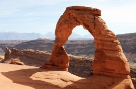
Natural Bridge
More of an arch than a true natural bridge, the feature was formed over time by rain and frost erosion from the rock top. The effect? Magnificent.
Paria View
The Paria River valley and Table Cliffs Plateau act as the backdrop to Paria View. Feast your eyes on hoodoos and the Navajo Sandstone that make up the White Cliffs.
Ponderosa Canyon
Ponderosa Canyon is home to pine-covered foothills circling the multicoloured hoodoos Utah’s renowned for.
Sunrise, Sunset, Inspiration and Bryce Points
Bryce Amphitheatre is the largest natural amphitheatre in Bryce Canyon National Park. It’s flanked by Sunrise Point, Sunset Point, Inspiration Point and Bryce Point.
Pick up Queen’s Garden Trail at Sunrise Point. From there, hike towards Thor’s Hammer and Wall Street.
Take in the ultimate view of Silent City from Inspiration Point, or the distant Black Mountains and Navajo Mountain at Bryce Point via the Under-the-Rim Trail.
Yovimpa and Rainbow Point
On a clear day in southern Utah you’ll see Navajo Mountain and the Kaibab Plateau some 90 miles away from Yovimpa and Rainbow Point. And the foreground ain’t too shabby either, featuring multicoloured eroded slopes and remnant hoodoos.
The Poodle
The Poodle hoodoo sits northwest of Rainbow Point. Tricky to locate, but well worth the effort, it’s the stuff of artists’ dreams. On four wheels? From Rainbow Point drive along the canyon rim. The scenic road will loop back towards the park entrance.
Hiking
Whatever your level of fitness or experience, Bryce Canyon National Park encompasses hiking trails to suit. Breeze through a relaxed, scenic walk, or take things up a notch with an intense back-country hike.
Fancy taking things easy?
If you don’t fancy getting too much of a sweat on, the 4.7 mile Rim Trail is sure to fit the bill. Taking in popular vistas including Sunset Point, Sunrise Point, Bryce Point and Inspiration Point, the gentle trail ascends roughly 200 vertical feet.
Hiking with a stroller or wheelchair in tow? The trail section between Sunset and Sunrise points is paved for accessibility.
The air up there
If your heart’s set on a more challenging hike, from Sunset Point head towards Bryce Amphitheatre via the Navajo Loop Trail, which features everything from steep-walled hoodoo formations to dense gatherings of Douglas fir trees.
The strenuous ascent includes a 2.2-mile loop to 521 feet above the amphitheatre floor. Remember: at elevations just shy of 8000 feet, you’ll feel the effects of the thinner air.
Are you a glutton for punishment? Then extend your hike 1.5 miles by taking in the Queen’s Garden Trail. Named after Queen Victoria, the trail’s unique rock formations are said to resemble the former monarch. After passing Gulliver’s Castle and the Queen’s Castle, finish at Sunrise Point.
Feast your eyes on Fairyland Loop
Despite being a less frequented trail, the magically-monikered Fairyland Loop is well worth a look.
Starting outside the park’s main area at Fairyland Point, the track hugs stunning limestone hoodoos some 1000 feet down. Connect to neighbouring hikes through Fairyland and Campbell amphitheatres, past the Boat Mesa formation.
At the southern end of Bryce Canyon Park, sitting at a whopping 9115 feet, is Rainbow Point – as the name suggests, the vista is something special.
Stroll along Bristlecoop Loop Trail for a mile, or take the spur trail leading to Grand Staircase Escalante National Monument at Yovimpa Point.
Horseback Riding
Few modes of transport enable folks access all areas in like horseback trail riding. Hop aboard your trusty steed and take in Bryce Canyon amphitheater.
Follow in the footsteps of the outlaws that made Utah famous, like Butch Cassidy, and mosey through scenic Red Canyon or the remote Paunsaguant Plateau. Bryce Canyon features orange-pink spires, hoodoos, and a complex maze of narrow passages – it’s little wonder, then, that early Utah rancher Ebenezer Bryce once described it as a “helluva place to lose a cow.”
Mountain Biking
Bryce Canyon is home to 41,431 acres, every last one seemingly purpose built for outdoor adventuring.
Whatever your fitness, you’re guaranteed to find a trail to suit along the 34 mile single track. Grab your mountain bike and let’s go. The Bryce Canyon region’s Red Canyon welcomes cyclists, who’ll be wowed by both the scenery and terrain.
Please note: Bryce Canyon National Park is not open to riders.
Paved Trails
Meandering its way through Red Canyon, from Thunder Mountain Trail head to the upper plateau’s Coyote Hollow Road, the paved Red Canyon Bicycle Trail offers a challenging assent for cyclists, hikers and other cross country enthusiasts, with an elevation between 7200-8000 feet.
Off-Road and Unpaved Trails
Head off-road and tackle the kind of outdoor challenge offered only by Utah’s top unpaved trails. The 5.5 mile long Casto Canyon Trail features breathtaking red rock scenery, big pines and hoodoos aplenty.
Fancy a detour?
Losee Canyon Trail, at just 2.9 miles, connects to Cassidy Trail, Casto Canyon in the north, and Red Canyon in the south.
Not for the fainthearted,
Thunder Mountain Trail boasts 7.8 miles of terrain, from the upper large ponderosa pine forest to the lower red rock. Be prepared for both smooth up and down, plus steep switchbacks.
Like the Thunder Mountain Trail, the 8.9 mile-long Cassidy Trail scales both red rock country and ponderosa pine. Believed to have once been the stomping ground of famed outlaw Butch Cassidy, scenery doesn’t get more stunning than this. Brace yourself for a trail that’s technical.